Land for sale
Kingsbury, Tamworth, Warwickshire, B78 2HJ
Guide Price
£650,000
SOLD
UNDER OFFER
Marketed by
Howkins & Harrison, Atherstone15 Market Street,
Atherstone,
Warwickshire,
CV9 1ET
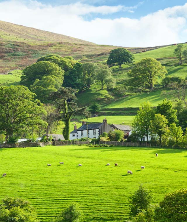
- 35.91 acres of agricultural land with strategic development potential on the edge of Kingsbury, bordering the River Tame.
- VAT is payable on this transaction
- Strategic development opportunity
- Good location
- Good transport links
- Previously a safeguarded development site in the draft Local Plan
35.91 acres of agricultural land with strategic development potential on the edge of Kingsbury, bordering the River Tame.
Distances
•M42 Junction 9 – 3 miles
•Tamworth – 4 miles
•Birmingham Airport & International Railway station – 10 miles
• Central Birmingham – 11 miles
•Coventry – 13 miles
•Solihull – 14 miles
Location
The land is located immediately adjacent to the northwest edge of the large village of Kingsbury in North Warwickshire. There are a number of facilities and services within the village which include a primary school, secondary school, swimming pool, two public houses, doctors surgery and a number of shops.
The village is popular with commuters and is superbly placed for access to the motorway network and the city of Birmingham.
Junction 9 of the M42 is approximately 3 miles from the land and from there, central Birmingham is readily accessible via the A446, M6 and Aston Expressway.
Description
The land is a block of gently undulating agricultural land, adjoining the northwest boundary of the settlement. There is a steep area of land along the riverbank between the River Tame and the existing development.
The land is classified as Grade 3 on the provisional Agricultural Land Classification, which indicates good to moderate land.
The land benefits from approximately 230m of road frontage to the A51 on its eastern boundary and a long frontage to the river. There is currently an agricultural access off the A51.
Town and Country Planning
Planning policy for the area is governed by North Warwickshire Borough Council. The land was submitted to the Strategic Housing and Employment Land Availability Assessment (SHELAA) reference PB207 and known as Land Adjoining Ralph Crescent. The SHELAA indicates a yield of 331 dwellings, on a developable area of 16.97ha. A copy of the draft master plan previously submitted to North Warwickshire Borough Council is included in these particulars.
The land has been promoted through the current North Warwickshire Local Plan process by the current owners. Until revisions to the draft plan were made following the Examination in Public, the site was identified in the draft Local Plan under Policy LP4 as ‘safeguarded land for future development’ see plan opposite. Comments on the draft Local Plan by the Planning Inspector and revisions to the proposed route of HS2 Phase 2b caused the planning authority to delete Policy LP4 from further stages of the Local Plan. Whilst the site does not currently have a draft allocation, HS2 Phase 2b from Birmingham to Leeds has since been cancelled and replaced by HS2 East, which is a proposed line from Birmingham to East Midlands Parkway. At present however, this scheme only exists in the form of a safeguarded area through the land. This is shown on the inset plan on the master plan. There are no published timescales for its implementation and due to concerns over the HS2 budget generally it is conceivable that HS2 East may be permanently shelved, which would remove one of the council’s reasons for deleting policy LP4.
Possession
The land is occupied by a tenant on a tenancy agreement protected by the Agricultural Holdings Act 1986. There is no written tenancy agreement in existence as far as the vendors are aware, although a notice under Section 6 of the Agricultural Holdings Act 1986 has been served to prevent the further assignment of the tenancy. The current rent is £2,000 per annum. The terms of the Agricultural Holdings Act allow the landlord to regain possession for non-agricultural uses, including development.
Tenure
The property is offered for sale freehold. Please note the land is opted to tax, so VAT will be payable on top of the sale price.
Services
We do not believe that the land benefits from any services, although we understand that all mains services are located close by.
Lotting
The vendor reserves the right to offer the property for sale in any other order than that described in these particulars to sub-divide, amalgamate or withdraw the property from sale without prior notice.
Rights of Way, Easements & Wayleaves
A high voltage electricity line crosses the property from southwest to northeast, for which annual wayleave is paid.
Outgoings
There are believed to be nil outgoings.
Method of Sale
The property is offered for sale as whole by private treaty.
Viewing Arrangements
The land can be viewed by booking an appointment via the Atherstone office Tel: 01827-721380
Local Authority
North Warwickshire Borough Council
https://www.northwarks.gov.uk/site/
Plan, Area & Description
The plan, area and description and believed to be correct in every way, but no claim will be entertained by the vendor or their Agents in respect to any error, omissions or misdescriptions.
The plan is for identification purposes only and is not to scale.
Contact
Howkins & Harrison Atherstone, rural property team
Anti Money Laundering
Under the Money Laundering Directive (S1 2017/692) we are required under due diligence as set out under HMRC to take full identification (e.g. Photo ID and recent utility bill as proof of address) when a potential purchaser submits an offer for a property. Please be aware of this and have the information available.