Arable Land and Woodland
Abberley, Worcester, Worcestershire, WR6 6AD
Guide Price
£150,000
SOLD
UNDER OFFER

Marketed by
Halls Estate Agents, Kidderminster137 Franche Rd,
Kidderminster,
Worcestershire,
DY11 5AP
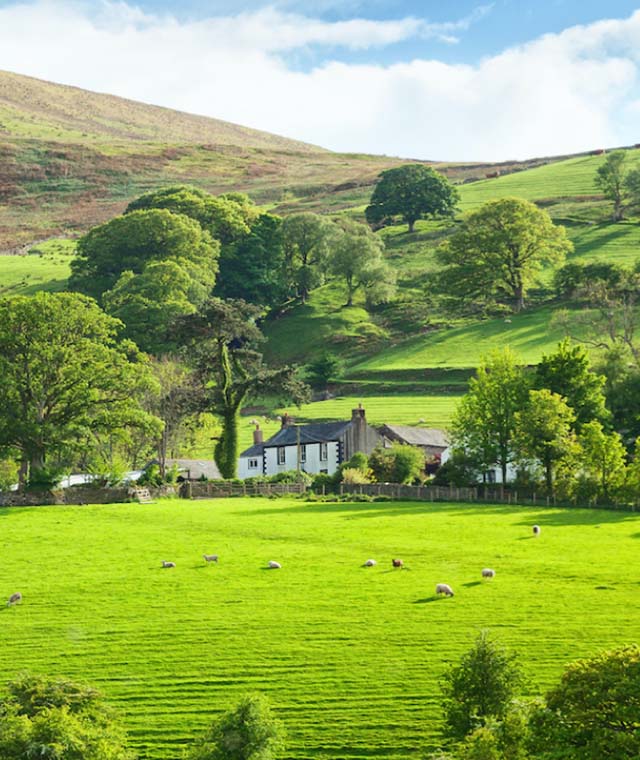
- The field is split into two sections, the arable field which amounts to 8.2 acres in one convenient block, and a further 5.59 acres of mixed woodland.
- 13.79 Acres of Grade 3 Arable Land and Woodland
- Sought After Village of Abberley
- 8.2 acres of Arable Land
- 5.59 acres of Mature Deciduous Woodland
- Superb Future Investment
- Redundant Quarry
DESCRIPTIONThe land is classified as Grade 3 Arable land on the Provisional Agricultural Land Classification (ALC) Maps, extending to 13.79 acres (5.57 hectares). The field is split into two sections, the arable field which amounts to 8.2 acres in one convenient block, and a further 5.59 acres of mixed deciduous woodland which includes mature and younger trees. Within the woodland there is a disused stone quarry. Development potential subject to planning.
SITUATION
The land is situated within the village of Abberley and is accessed off Apostles Oak Road and extends to 13.79 acres of arable land
and woodland.
VIEWING
At any reasonable daylight hours with a copy of these particulars to hand.
FIELD FIXTURES AND FITTINGS
Only those items described in these sale particulars re included within the sale.
TENURE
Freehold with vacant possession upon completion.
BASIC PAYMENT SCHEME
the land has not been claimed on under the Basic Payment Scheme recently and there are no Basic Payment Entitlements
included within this sale.
COUNTRYSIDE STEWARDSHIP
There are no current CSS Agreements on the land.
SPORTING, MINERAL AND TIMBER RIGHTS
All standing timber and timber rights are included in the sale.
All sporting rights are included in this sale.
All mineral rights are included in this sale.
SERVICES
There are no services connected to the land. It is believed there is a mains water connection within the adjacent highway.
PLANS, AREAS AND SCHEDULES
These are based on the more recent Ordnance Survey ProMap plans from which the areas have been calculated. The purchaser should be deemed to have satisfied himself as to the boundaries of the property together with the area. Any errors or mis-statement should not entitle the purchaser to annul the sale or receive any compensation in respect thereof.
RIGHTS OF WAY
The property will be sold subject to any wayleaves, public or private rights of way, easements and covenants and all outgoings whether mentioned in the sales particulars or not.
There is a public right of way as depicted by the green line on the plan on the rear of these particulars.
There is a Right of Access from point A to B as depicted in the purple line, the purchaser will be required to install a 4-meter gate into the field at point B. This Right of Access is permitted for access for the purposes of agricultural and forestry.
BOUNDARIES
The purchaser shall be deemed to have full knowledge of the boundaries and roads and neither the vendor nor the agent will be responsible for defining the ownership
VENDORS SOLICITOR
Sarah Astbury
Seymour Legal,
Gemini House,
Stourport Road,
Kidderminster,
DY11 7QL
METHOD OF SALE
The land is to be offered for sale via Best and Final Offers. The deadline date for this is the 17th April 2023 at 12 noon.
MONEY LAUNDERING REGULATIONS
On putting forward an offer to purchase, you will be required to provide evidence of funding together with adequate identification to prove your identity within the terms of the Money Laundering Regulations (MLR 2017) E.G. Passport or photographic driving license and recent utility bill.
FURTHER INFORMATION
For additional information please contact Charlotte Hurley at our Kidderminster office on 01562 820880
Email: churley@hallsgb.com
Mob: 07983 271543
DIRECTIONS
From the nearest town of Stourport-On-Severn, head south west on the Dunley Road (A451) for 3.4 miles before turning right after crossing the Dick Brook, turn immediately left then carry on along this road for 1.6 miles before turning left as you come into the Village of Abberley. Continue along this lane for 0.2 miles before turning right onto Wynniatts Road. Continue along this road until you reach the T-junction after approx. 0.6 miles. Turn right at the junction and then immediately right again at the fork in the road onto the B4202, carry on along here for 0.3 miles and the land is on located on your right.